
Our staff, with the widening to the third lane on the A14 motorway, has extended the knowledge about the correct use of the milling machine and paver with 3D systems.
Talking about the new roads, the systems on the cutter can be used to fix the errors appeared due to the intermediate construction phase, paying attention to the temporary paving of road infrastructures in operation which are used to cross platforms not yet in project.
It is possible to load the original project onto the paver avoiding wires or other elements and, if necessary, correct any defects in the road foundation if built at a lower height than the design one, otherwise there would be a risk to save the flatness and not the design thickness.
If a survey shows that the road foundation isn’t built correctly, the assisted cutter can fix the situation, spreading as desired (in a better way with a longitudinal bar with ultrasound altitude sensors).
But the real priceless advantage of 3D systems is the restoration of flatness on existing roads.
Starting from an essential survey with the rules mentioned below, the designer is able to analyze the longitudinal and transversal platform trend, considering negative points to realize a better project without upsetting the existing one but bringing the road axis back to its original flatness and getting a better result.
1. SURVEY PHASE
To guarantee the best precision in the survey phase, during the design and the construction phase, it is necessary to go on with the materialization and measurement of a network of cornerstones with planimetric coordinate obtained by carrying out a polygonal structure with total station.
The altimetric coordinate must derive from a precision leveling through the geometric leveling method.
Our staff is equipped with the Trimble MX9 Mobile Mapping system to obtain the best result.
Ground control points (GCPs) are placed to identify the point cloud considering the dimension and the characteristics of the concerned highway. These GCPs are located on the platform, detected using total stations and oriented on the cornerstones mentioned before.
Analyzing the compensated point cloud on the GCPs, the 3D survey of the road platform will be converted in AutoCad format with breaklines and points necessary for the correct design.
2. 3D PROJECT PHASE
Considering that the project aims to improve the road platform (whether it is a new one or an existing one that needs to be restored), it will consider the relevant documents in AutoCad format mentioned below with all the constraints dictated by the client and by the state of places.
The delivery documents are:
-The longitudinal profile in the tracing axis for each carriageway pointing out the height referred to the survey and project trend, the vertical connections and the cross sections. According to the last one, the deviation between the design and survey values will be highlighted;
– sections with 10 range showing the survey with the elements indicated in the survey paragraph, the project highlights the height of the barriers and the transverse slope and the deviation between project and survey In correspondence with the edges and the axis of the horizontal signs.
– plan on an adequate scale (1: 200, 1: 500, 1: 1000 depending on the specific client order) reporting all the main points;
– 3D design polylines of the following breaklines:
– roadsides
– 3 meters offsets of the roadsides that consider the transverse slope;
– road marking axis.
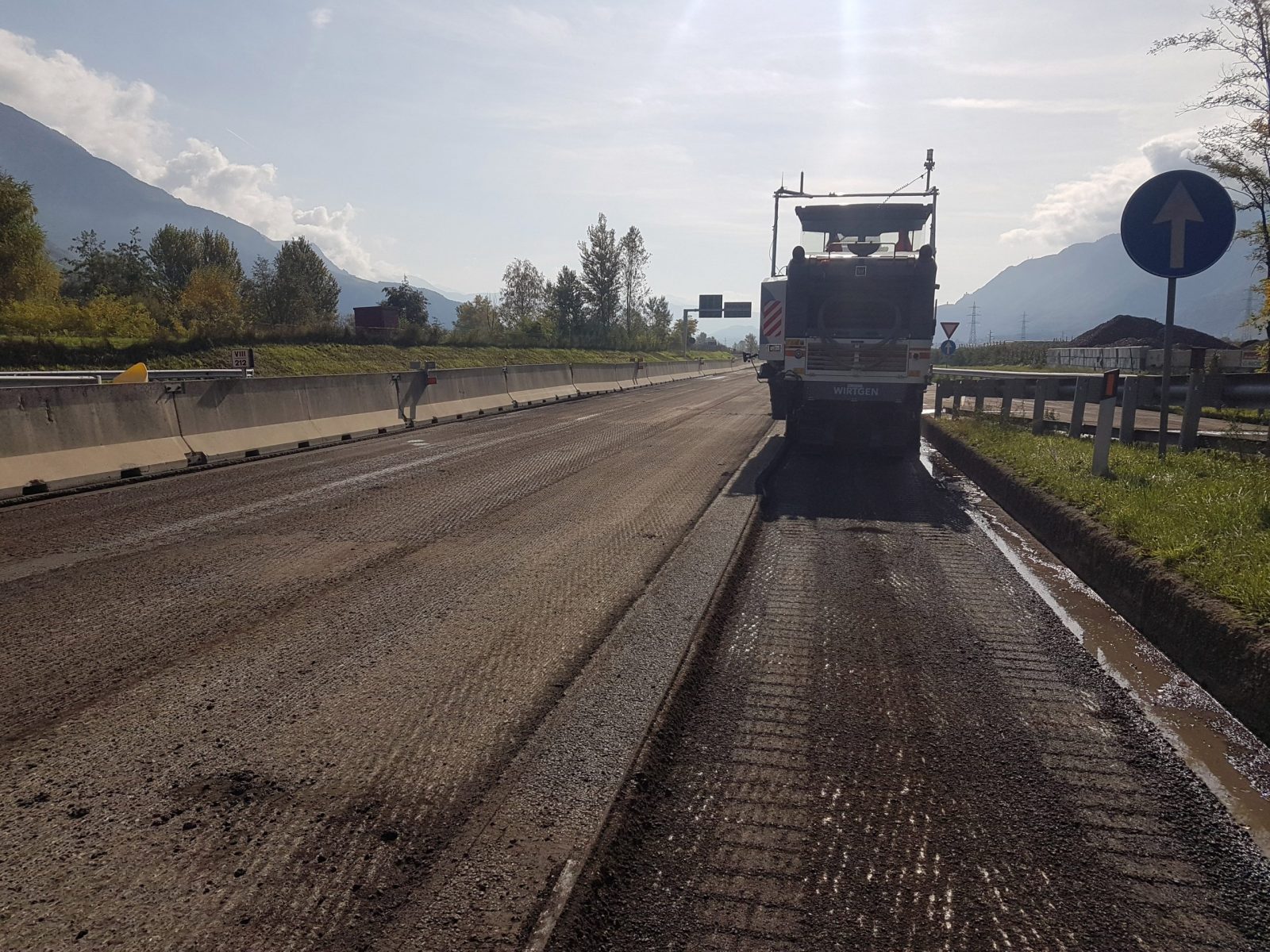
3. REALISATION PHASE.
Our surveyors process a DTM with the 3D polylines of the project and this DTM is loaded on cutters and / or pavers equipped with a 3D system.
The system is governed by robotic stations which communicate their position orienting themselves on the cornerstones as mentioned in the point 1, via a special radio interface to the vehicles equipped with a pole and a special optical prism.
A topographer verify the exact transposition of the project, having previously loaded the project on other tools suitable for this activity and oriented on the same cornerstones following the milling or paving activity and fixing the errors.
Before the beginning of every activity, stage of laying or milling, the correspondence between the height indicated by the system and the height detected by the instruments has to be checked because the values must coincide.
The Trimble MX9 System is installed on top of the vehicles and can capture ultra-high density point clouds, georeferenced panoramic and multi-angle images (360 ° camera, right side, left side and rear for platform photography). Detailed carriageway data can be collected at motorway speeds, significantly improving data collection on busy roads and avoiding expensive road closures. It is the latest generation solution for today’s needs.